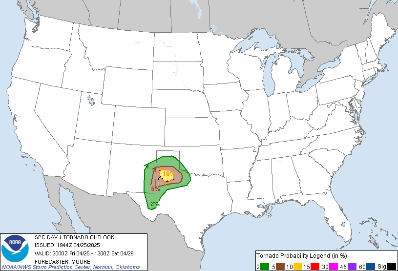
Our crew had a good lunch at IHOP and did some shopping in Lubbock and headed south towards Odessa for today's target. It was a nice and easy day with little travelling. We were expecting today to be similar to the storms from the other night, with the cap breaking later in the day.
As we were heading further south, we saw darkening skies off to the southwest around 2 pm. I noted a couple of inflow bands, one coming from the east and the other coming from the north. Baron had detected 2 inch hail and the updrafts were increasing. There were quite a few CGs and some positive strikes as well. Sandra had noted that the temperature dropped 6 degrees a half hour later. We had crossed a boundary.
Behind this little storm was a larger supercell that had popped up on radar around a quarter after four on the New Mexico/Texas state border and was due east. A tornado warning had been issued. We went through Odessa and took highway 302 westward. We saw the Tornado Intercept Vehicle once again on this trip, parked on an overpass. A wall cloud appeared just west of town. Ron noted that this storm had become a right mover... oh boy! Things were going to get interesting. We actually had trouble finding a good viewing spot to get ourselves in position. A bunch of desert trees were in the way. Trying to watch a wall cloud with tornado potential through all that was quite frustrating. About 10 minutes later, we parked at a good viewing spot. At around a quarter to five, all of a sudden we saw it... a wedge shaped tornado! Holy crickey! I've never seen one this big before so this was definitely new to me. According to Ron, this was approx 20 km away from where we were, so the tornado must have been almost three quarters of a mile wide. We got reports on the radio that a sherriff had reported a tornado on the storm. Wow... okay so we weren't seeing things afterall! The tornado went from a wedge shape to a stovepipe and then fizzled out a couple minutes later. I was really glad that it hit somewhere in the middle of nowhere on a county line and not right in town.
After all that excitement, we continued a little more east to get some structure shots. Wow what beautiful undercut wall cloud structure. There was actually blue colours in the undercut area! We watched this for a good several minutes as it came towards us and got great imagery. Since the core in behind was coming this way, we decided to head south, closer to town, to get into a bit of hail. We stopped on the side of the highway and watched in amusement as one inch stones pounded the vehicles and accumulated on the ground in some spots. The road was pretty much covered in the stuff before the rain came.
After that, we decided we were pretty pleased with what we caught today and headed to our hotel in Odessa. We had a beer and steak dinner at the restaurant located in the hotel but the overall quality was somewhat mediocre. Half of the steaks were not cooked right and they weren't as tender and lean as other steaks we've had several days ago. Plus it took forever to get our food and our tickets. The place wasn't even busy. We managed to get a free drink on the house for the poor steak quality and then waited and waited for our tickets. Dave went up twice asking for our tickets, but somehow the manager couldn't figure it out. After waiting too long, we gave up and left. Okay so today wasn't bad afterall... a tornado and free dinner!
Tomorrow it looks like we are headed right down the highway not too far from here. I must say that Ron's uncanny when it comes to predicting storms right down to a highway.
Monday, June 04, 2007


Sunday, June 03, 2007
Day 8 June 2, 2007
We left Wichita Falls around noon after eating a good brunch at Denny's. We were going to head southwest around the Lubbock area today. I really liked the southeast backing winds this time. Today could turn out to be something more decent than yesterday. SPC had issued a 5% tornado risk area for the caprock. Supercells were likely with possibly a few tornadoes, but they could evolve into a bow echo later in the day from the upslope flow. Surface based CAPE was close to 4000 J/kg with a lifted index of -8.
I think we were in for one lucky day today. Sandra was sitting in the front passenger seat in the van and she had her window rolled down. All of a sudden, a bird crapped in the window right on Sandra's lower lip and I even got a bit on me - I was sitting in the middle seat! Scott said we were in for a really good day. Gross but I guess this was a sign of really good things to come!
We decided to have a break in Lubbock. The cap was still holding. Some TCU's would try to go up but would hit the inversion layer and get ripped apart. We grabbed something to eat while Ron went to download models. We stayed there for about an hour or so then Ron said we should go get our rooms and wait. I was really curious what was happening just to our north... I could see an anvil. I checked radar and there was a storm that was trying to go supercellular to the north about two counties away. After several scans, this thing was trying to organize itself. It also had pretty good hail from it and it was slowly moving to the east-southeast. I decided to tell Scott about this storm. Him and Lee just had a swim in the pool, while Sandra was working out on a treadmill. All of a sudden, Ron came in and said to pack up our things. We were going to intercept this storm since it was the only one out there. YAY! I must say I don't think we've ever departed so quickly yet on this trip before. We left at 7:30 and gased up quickly. We headed north towards Hale and Lamb counties.
The anvil was beautiful with its overshooting top. It just kept backbuilding. The edges of the anvil would go soft and then knuckle out again. At a quarter after eight, there was also a great flanking line, with the sun setting in behind and a corkscrewing updraft. What a great looking vault region! It made for great images. When we neared the storm we got reports of a tornado 5 miles east of Sunnyside... we were not very far from this at all, but I think we were several minutes too late to see the tornado. Ron said the core of this supercell was 10 miles wide, and it was moving 17 mph southeast. Ten minutes later, we saw a wall cloud forming near the flanking line. It was so neat to see with the sunset in behind. When we went through the town of Earth, we saw another wall cloud forming. We now had two areas to watch. A small light coloured funnel cloud came out of the new wall cloud, but didn't last long.
We continued to get more west. We then cut south a little bit. Baron had picked up two rotation couplets. We were keeping our eye on the second wall cloud when I spotted a funnel cloud going halfway to the ground! I really thought this was gonna be it. We went up the road a little bit and stopped to get images, but the funnel cloud had dissipated by then. I couldn't tell if there was a debris swirl underneath it, but it sure looked pretty good. It started to rain and we continued southward again and then east. We stopped once more to get some pictures. Then it started to rain, so we headed east and then south once again. The rear flank downdraft had opened up and dust started to get kicked up. We drove through the thick dust.
We would get ahead of the precip core a little bit, pull over and get some quick lightning images, but it wouldn't be long before we could hear the hail approaching. Dave had got pinged right on his upper lip by a hail stone. Ron came on the radio and said that a hook echo was starting to form. We got ahead of the hail again and stopped for lightning pictures once more. I got one really cool looking image this time. In the photo there was a tilted updraft that looked like it was corkscrewing slightly. A tornado warning had been put out for Lubbock and vicinity by now. The hail once again caught up to us and we went due southeast towards Lubbock. The storm started to weaken so we went for a quick dinner at McDonald's since nothing else was opened. It sounded like we would be basing out of Lubbock for at least another day.
I think we were in for one lucky day today. Sandra was sitting in the front passenger seat in the van and she had her window rolled down. All of a sudden, a bird crapped in the window right on Sandra's lower lip and I even got a bit on me - I was sitting in the middle seat! Scott said we were in for a really good day. Gross but I guess this was a sign of really good things to come!
We decided to have a break in Lubbock. The cap was still holding. Some TCU's would try to go up but would hit the inversion layer and get ripped apart. We grabbed something to eat while Ron went to download models. We stayed there for about an hour or so then Ron said we should go get our rooms and wait. I was really curious what was happening just to our north... I could see an anvil. I checked radar and there was a storm that was trying to go supercellular to the north about two counties away. After several scans, this thing was trying to organize itself. It also had pretty good hail from it and it was slowly moving to the east-southeast. I decided to tell Scott about this storm. Him and Lee just had a swim in the pool, while Sandra was working out on a treadmill. All of a sudden, Ron came in and said to pack up our things. We were going to intercept this storm since it was the only one out there. YAY! I must say I don't think we've ever departed so quickly yet on this trip before. We left at 7:30 and gased up quickly. We headed north towards Hale and Lamb counties.
The anvil was beautiful with its overshooting top. It just kept backbuilding. The edges of the anvil would go soft and then knuckle out again. At a quarter after eight, there was also a great flanking line, with the sun setting in behind and a corkscrewing updraft. What a great looking vault region! It made for great images. When we neared the storm we got reports of a tornado 5 miles east of Sunnyside... we were not very far from this at all, but I think we were several minutes too late to see the tornado. Ron said the core of this supercell was 10 miles wide, and it was moving 17 mph southeast. Ten minutes later, we saw a wall cloud forming near the flanking line. It was so neat to see with the sunset in behind. When we went through the town of Earth, we saw another wall cloud forming. We now had two areas to watch. A small light coloured funnel cloud came out of the new wall cloud, but didn't last long.
We continued to get more west. We then cut south a little bit. Baron had picked up two rotation couplets. We were keeping our eye on the second wall cloud when I spotted a funnel cloud going halfway to the ground! I really thought this was gonna be it. We went up the road a little bit and stopped to get images, but the funnel cloud had dissipated by then. I couldn't tell if there was a debris swirl underneath it, but it sure looked pretty good. It started to rain and we continued southward again and then east. We stopped once more to get some pictures. Then it started to rain, so we headed east and then south once again. The rear flank downdraft had opened up and dust started to get kicked up. We drove through the thick dust.
We would get ahead of the precip core a little bit, pull over and get some quick lightning images, but it wouldn't be long before we could hear the hail approaching. Dave had got pinged right on his upper lip by a hail stone. Ron came on the radio and said that a hook echo was starting to form. We got ahead of the hail again and stopped for lightning pictures once more. I got one really cool looking image this time. In the photo there was a tilted updraft that looked like it was corkscrewing slightly. A tornado warning had been put out for Lubbock and vicinity by now. The hail once again caught up to us and we went due southeast towards Lubbock. The storm started to weaken so we went for a quick dinner at McDonald's since nothing else was opened. It sounded like we would be basing out of Lubbock for at least another day.
Saturday, June 02, 2007
Day 7 June 1, 2007
Today marks the halfway point of our trip. As we were going through Liberal, Kansas to get ready to depart south, we happened to spot the Tornado Intercept Vehicle and a couple of Project ROTATE vehicles parked at a motel. We decided to have a closer look at this interesting piece of metal on wheels. Let's just say that I would never be caught dead riding in that thing... but I do give credit to the guy who drove this TIV all the way from California!
We were to head south into the Texas panhandle today, just south of Lubbock, possibly on the New Mexico state line. There was a large tornado risk area for today according to the SPC. I never did get a chance to download models last night to see what was cooking for today because we pulled in late and I was pretty tired, but Ron was going to download anyways.
While on the way down, we saw numerous fields flooded out by a previous storm system that went through several days ago. A lot of rain must have fallen here because the puddles were still pretty big and almost look like small lakes. When we got closer to Amarillo, we saw two small storms, one to the west and another to the southeast. Mammatus could be seen under the anvil of the western storm, while an interesting inflow band on the southeastern storm grew fatter and eventually attached itself to the base of the storm. Since I was riding with Sandra in Ron's car, I decided to check the Baron to see what was cooking. These appeared to be small supercells with no rotation couplets. When we arrived in Amarillo, we went to eat a buffet lunch at a place called Furr's. For under eight bucks you definitely cannot go wrong. The food was delicious.
We swapped seats once again and continued our trek south of Amarillo towards Lubbock. We took highway 114 just east of Lubbock. The storm that was to our southeast now had 4 rotation couplets on it according to the Baron and that it was moving 20 mph southeast. Ron said. A tornado warning had been issued. We were going to intercept it because this was all that was available at this time. As we got closer, we saw a nice hail shaft and hailbow. The hail shaft actually had quite a foot on it, indicating the strong outflow winds. From this vantage point, it looked like there was low level moisture being fed into the storm updrafts. We headed towards Abilene, and went through a rain/hail core that had poor visibility. In Aspermont, we gased up and had a quick restroom break, then continued on highway 283.
By this point, the storm didn't look very good at all... there was a lot of outflow from the hail core, and that was cutting off the much needed inflow to this storm. The bases had clear breaks in them. Crap. At one point, after heckling this "great big storm of Texas", scud tried to gather and form a wall cloud. I saw a brief skinny pointy funnel cloud come out of it, but that was all that it amounted to. We pulled off the highway to take some pictures. It looked like a small shelf cloud was pushing its way through over us, and off in the distance to the south I was watching a pretty good piece of scud rise up and attach itself to the base of the storm. It then started to rain, and we continued on highway 277.
At around 7:30 pm we punched the core of the storm... it wasn't a real threat since the biggest hail was past us. Flash flood warnings had been issued. I could see why... the area was already saturated and there was decent ponding on the roadways. On the way north, we stopped two times for mammatus pictures shortly after 8 pm. On the way into Wichita Falls, we were treated to a cool lightning display. We had a nice steak dinner and are staying at a Best Western in Wichita Falls.
We were to head south into the Texas panhandle today, just south of Lubbock, possibly on the New Mexico state line. There was a large tornado risk area for today according to the SPC. I never did get a chance to download models last night to see what was cooking for today because we pulled in late and I was pretty tired, but Ron was going to download anyways.
While on the way down, we saw numerous fields flooded out by a previous storm system that went through several days ago. A lot of rain must have fallen here because the puddles were still pretty big and almost look like small lakes. When we got closer to Amarillo, we saw two small storms, one to the west and another to the southeast. Mammatus could be seen under the anvil of the western storm, while an interesting inflow band on the southeastern storm grew fatter and eventually attached itself to the base of the storm. Since I was riding with Sandra in Ron's car, I decided to check the Baron to see what was cooking. These appeared to be small supercells with no rotation couplets. When we arrived in Amarillo, we went to eat a buffet lunch at a place called Furr's. For under eight bucks you definitely cannot go wrong. The food was delicious.
We swapped seats once again and continued our trek south of Amarillo towards Lubbock. We took highway 114 just east of Lubbock. The storm that was to our southeast now had 4 rotation couplets on it according to the Baron and that it was moving 20 mph southeast. Ron said. A tornado warning had been issued. We were going to intercept it because this was all that was available at this time. As we got closer, we saw a nice hail shaft and hailbow. The hail shaft actually had quite a foot on it, indicating the strong outflow winds. From this vantage point, it looked like there was low level moisture being fed into the storm updrafts. We headed towards Abilene, and went through a rain/hail core that had poor visibility. In Aspermont, we gased up and had a quick restroom break, then continued on highway 283.
By this point, the storm didn't look very good at all... there was a lot of outflow from the hail core, and that was cutting off the much needed inflow to this storm. The bases had clear breaks in them. Crap. At one point, after heckling this "great big storm of Texas", scud tried to gather and form a wall cloud. I saw a brief skinny pointy funnel cloud come out of it, but that was all that it amounted to. We pulled off the highway to take some pictures. It looked like a small shelf cloud was pushing its way through over us, and off in the distance to the south I was watching a pretty good piece of scud rise up and attach itself to the base of the storm. It then started to rain, and we continued on highway 277.
At around 7:30 pm we punched the core of the storm... it wasn't a real threat since the biggest hail was past us. Flash flood warnings had been issued. I could see why... the area was already saturated and there was decent ponding on the roadways. On the way north, we stopped two times for mammatus pictures shortly after 8 pm. On the way into Wichita Falls, we were treated to a cool lightning display. We had a nice steak dinner and are staying at a Best Western in Wichita Falls.
Friday, June 01, 2007
Day 6 May 31, 2007
In the morning, Ron, Sandra and I went to do some laundry and ate a decent breakfast in Amarillo. Sandra and I decided to go to Wall Mart so I could get a good pair of polarizing sunglasses. We didn't leave Amarillo until closer to noon. Today, our target was going to be near southwest Kansas. A dryline bulge was setting up in that area and the SPC issued a moderate risk.
When the first storm went up, the first tornado watch was issued. We saw nice TCU building up in the west, each one in a different stage. And further north of these cells, a larger "nuke" could be seen off in the distance. All of these growing storms were bubbling. It was pretty clear we had good lift today. A second tornado watch was issued for the Oklahoma panhandle for the upcoming storms. "Be afraid, be very afraid."
Going through Oklahoma, we went by a town called Cactus. It was obvious this small town got hit by a tornado a while back this season. We decided to take a drive in just down the road a little bit to see what all got damaged. Houses suffered structural damage, and had X marks spray painted on the front doors to indicate that the house was searched for people. A metal fence in front of one house was even bent. Trees were twisted, car windows were busted out, and a children's dome jungle gym was practically squashed. It's one of those sights that make you realize the true power of tornadoes, even if they are small.
We then went through the town of Hooker. This place had a "nice" welcome sign... "Home of the Horny Toads".
When we arrived closer to the storms which was over far eastern Colorado near Burton, it didn't look like much at first, but we could tell something was up... the anvil's edges were getting crisper looking and I saw signs of inflow. The road we took to getting near the storm was an interesting one... there were tons of pheasants everywhere. One almost hit the van's windshield. It looked like it was only a foot away, but it zig zagged itself out of the way. "HOLY COW DID YOU SEE THAT?!". Scott seemed to be pretty excited about that encounter. A little while later down the road, there was a small bird on the road and we were coming for it. It flew up in time, but the bird happened to fly in the wrong direction... in the windshield. SMACK! Thank goodness it didn't get wound up in the antennas and that no bird brains covered the windshield. Apparently there were even rabbits. Man this place was a zoo.
As we neared the storms, it was clear this thing was trying to organize itself. A lowering what looked like a developing wall cloud could be seen. We decided to intercept this storm that was located south of Stanton, Oklahoma. We saw the DOW truck and some mobile mesonet vehicles parked near a bend in the road (I think this was Project ROTATE). As we went down a dirt road (only do this when it's dry!) to get closer to the action, we saw nice low hanging mammatus clouds. All of a sudden, Ron then points out a possible landspout descending from the base. The Baron was now picking up rotation couplets on this storm. Several minutes later, the wall cloud started to get more organized. Then we saw it... a fairly decent sized funnel cloud! I grabbed the video camera and started taking video of it. We managed to pull off to the side of the road and get some images. Talk about some nice swirling action going on underneath the wall cloud! Unfortunately it was raining, and we couldn't stay too long so we had to head further south. It looked like this storm was taking breathers a few times... the wall cloud would really get together but then loosen up slightly. We managed to stop again for photo ops but had to get in the vehicles once more. We were playing tag with this storm, and didn't want to end up in the rain where we couldn't see this possible tornadogenesis. Several nice positive lightning strikes added to the scene. There was also chaser convergence. I couldn't believe the amount of chasers on one single road, although apparently there have been way worse cases other times. Lots of chasers were interested in this cyclic supercell, but everyone did really well traffic-wise.
Unfortunately we had to cut through the core of the storm to get south of it... that was the only road option we had. It got really hairy in there... there was plenty of nickel sized hail making loud banging noises on the van and lots of rain. We couldn't see around us at all! We finally managed to pull ourselves out of this mess. By now, a new wall cloud had formed near some really tiny town. We pulled off the road to take some images, and we could hear tornado sirens blaring loudly in the background. This wall cloud was REALLY spinning but it didn't drop a tornado! The motion alone was incredible. We were glad we got on this road in time because apparently some cops had closed access to the road we were on. We then saw another wall cloud forming to our north. We decided to head east at 7:20 pm. We cut through the core once again and were getting 1.5 inch hail. The wall cloud to our north was starting to fall apart, and there was a new one developing straight ahead of us. We stopped for a bit to get more pictures.
We got a road to take us south to get to the backside of this storm. We had to cut through the hail/rain core once more. We pulled to the side of the road to wait out the core and buffering winds for a bit. We were getting half inch hail. Scott went on the radio and said to Ron "Laura just volunteered to get a hail sample". Ok so Scott likes to volunteer me... I thought, I had half inch hail at home a few times so this would be no problem. So what did I do? I opened the door, stepped outside, got parts of my back pinged with one inch hail, grabbed two stones and went back inside the van. I showed them to Pam and Lee and they were amazed. The biggest stones were about one inch big.
We finally got out of the precip core. We saw another developing wall cloud with the rear flank starting to open itself up again. There was a brief funnel cloud at 7:42 pm, and a beaver tail was feeding into the wall cloud. The wall cloud was also sucking up moisture into it from the field at a good speed, but it started to break apart once more. There was also a nice glowing green precip core. It looked like at this stage of the game that there was a lack of inflow and backing southeast winds.
Continuing eastward, there was another smaller wall cloud that formed (surprise, surprise), although the rear flank was still trying to open itself up. Another brief funnel cloud protruded from the base slightly. Scott then noticed a column of brown colour underneath. A partial rainbow appeared. After all of these brief stops, a pile of dirt was building up inside my shoes and I had to go to the bathroom. We encountered the precip core again and finally got a road that headed south.
We encountered yet another developing wall cloud at 8:30. This storm was really trying hard to put something down! Ron noted that it was now trying to form a hook echo. A funnel cloud was trying to form, but just couldn't get its act together. We were now northwest of Guymon. We headed eastward once again. The storm was going through cyclic phases. Sometimes the rotation would look good and other times it appeared as if it was taking a breather.
The sun was setting now, and that meant it was going to get dark soon and storm would start to lose it's energy. Ron decided to call off the chase for the night and look for hotel rooms in Guymon. Unfortunately with the threat of tornadoes, a lot of people who were traveling in the area wanted to get bunkered down at the hotels. We couldn't find a room, so we managed to book something over in Liberal, Kansas. On our way to Liberal, we were treated to a great lightning display. We grabbed something quick to eat at McDonald's and are staying at a Super 8. Tomorrow it looks like we are headed to New Mexico.
When the first storm went up, the first tornado watch was issued. We saw nice TCU building up in the west, each one in a different stage. And further north of these cells, a larger "nuke" could be seen off in the distance. All of these growing storms were bubbling. It was pretty clear we had good lift today. A second tornado watch was issued for the Oklahoma panhandle for the upcoming storms. "Be afraid, be very afraid."
Going through Oklahoma, we went by a town called Cactus. It was obvious this small town got hit by a tornado a while back this season. We decided to take a drive in just down the road a little bit to see what all got damaged. Houses suffered structural damage, and had X marks spray painted on the front doors to indicate that the house was searched for people. A metal fence in front of one house was even bent. Trees were twisted, car windows were busted out, and a children's dome jungle gym was practically squashed. It's one of those sights that make you realize the true power of tornadoes, even if they are small.
We then went through the town of Hooker. This place had a "nice" welcome sign... "Home of the Horny Toads".
When we arrived closer to the storms which was over far eastern Colorado near Burton, it didn't look like much at first, but we could tell something was up... the anvil's edges were getting crisper looking and I saw signs of inflow. The road we took to getting near the storm was an interesting one... there were tons of pheasants everywhere. One almost hit the van's windshield. It looked like it was only a foot away, but it zig zagged itself out of the way. "HOLY COW DID YOU SEE THAT?!". Scott seemed to be pretty excited about that encounter. A little while later down the road, there was a small bird on the road and we were coming for it. It flew up in time, but the bird happened to fly in the wrong direction... in the windshield. SMACK! Thank goodness it didn't get wound up in the antennas and that no bird brains covered the windshield. Apparently there were even rabbits. Man this place was a zoo.
As we neared the storms, it was clear this thing was trying to organize itself. A lowering what looked like a developing wall cloud could be seen. We decided to intercept this storm that was located south of Stanton, Oklahoma. We saw the DOW truck and some mobile mesonet vehicles parked near a bend in the road (I think this was Project ROTATE). As we went down a dirt road (only do this when it's dry!) to get closer to the action, we saw nice low hanging mammatus clouds. All of a sudden, Ron then points out a possible landspout descending from the base. The Baron was now picking up rotation couplets on this storm. Several minutes later, the wall cloud started to get more organized. Then we saw it... a fairly decent sized funnel cloud! I grabbed the video camera and started taking video of it. We managed to pull off to the side of the road and get some images. Talk about some nice swirling action going on underneath the wall cloud! Unfortunately it was raining, and we couldn't stay too long so we had to head further south. It looked like this storm was taking breathers a few times... the wall cloud would really get together but then loosen up slightly. We managed to stop again for photo ops but had to get in the vehicles once more. We were playing tag with this storm, and didn't want to end up in the rain where we couldn't see this possible tornadogenesis. Several nice positive lightning strikes added to the scene. There was also chaser convergence. I couldn't believe the amount of chasers on one single road, although apparently there have been way worse cases other times. Lots of chasers were interested in this cyclic supercell, but everyone did really well traffic-wise.
Unfortunately we had to cut through the core of the storm to get south of it... that was the only road option we had. It got really hairy in there... there was plenty of nickel sized hail making loud banging noises on the van and lots of rain. We couldn't see around us at all! We finally managed to pull ourselves out of this mess. By now, a new wall cloud had formed near some really tiny town. We pulled off the road to take some images, and we could hear tornado sirens blaring loudly in the background. This wall cloud was REALLY spinning but it didn't drop a tornado! The motion alone was incredible. We were glad we got on this road in time because apparently some cops had closed access to the road we were on. We then saw another wall cloud forming to our north. We decided to head east at 7:20 pm. We cut through the core once again and were getting 1.5 inch hail. The wall cloud to our north was starting to fall apart, and there was a new one developing straight ahead of us. We stopped for a bit to get more pictures.
We got a road to take us south to get to the backside of this storm. We had to cut through the hail/rain core once more. We pulled to the side of the road to wait out the core and buffering winds for a bit. We were getting half inch hail. Scott went on the radio and said to Ron "Laura just volunteered to get a hail sample". Ok so Scott likes to volunteer me... I thought, I had half inch hail at home a few times so this would be no problem. So what did I do? I opened the door, stepped outside, got parts of my back pinged with one inch hail, grabbed two stones and went back inside the van. I showed them to Pam and Lee and they were amazed. The biggest stones were about one inch big.
We finally got out of the precip core. We saw another developing wall cloud with the rear flank starting to open itself up again. There was a brief funnel cloud at 7:42 pm, and a beaver tail was feeding into the wall cloud. The wall cloud was also sucking up moisture into it from the field at a good speed, but it started to break apart once more. There was also a nice glowing green precip core. It looked like at this stage of the game that there was a lack of inflow and backing southeast winds.
Continuing eastward, there was another smaller wall cloud that formed (surprise, surprise), although the rear flank was still trying to open itself up. Another brief funnel cloud protruded from the base slightly. Scott then noticed a column of brown colour underneath. A partial rainbow appeared. After all of these brief stops, a pile of dirt was building up inside my shoes and I had to go to the bathroom. We encountered the precip core again and finally got a road that headed south.
We encountered yet another developing wall cloud at 8:30. This storm was really trying hard to put something down! Ron noted that it was now trying to form a hook echo. A funnel cloud was trying to form, but just couldn't get its act together. We were now northwest of Guymon. We headed eastward once again. The storm was going through cyclic phases. Sometimes the rotation would look good and other times it appeared as if it was taking a breather.
The sun was setting now, and that meant it was going to get dark soon and storm would start to lose it's energy. Ron decided to call off the chase for the night and look for hotel rooms in Guymon. Unfortunately with the threat of tornadoes, a lot of people who were traveling in the area wanted to get bunkered down at the hotels. We couldn't find a room, so we managed to book something over in Liberal, Kansas. On our way to Liberal, we were treated to a great lightning display. We grabbed something quick to eat at McDonald's and are staying at a Super 8. Tomorrow it looks like we are headed to New Mexico.
Thursday, May 31, 2007
Mike Walker's blog
Here is a link to Mike Walker's blog:
http://2007-chase.blogspot.com/
He is one of the people on Ron's tour, and is writing daily summaries with some photos. I wish I could upload some pictures of my own, but I don't have the drivers installed, so the camera can't be recognized. I wish I had a card reader....
http://2007-chase.blogspot.com/
He is one of the people on Ron's tour, and is writing daily summaries with some photos. I wish I could upload some pictures of my own, but I don't have the drivers installed, so the camera can't be recognized. I wish I had a card reader....
Day 5 May 30, 2007
Today we actually got to sleep in, yay! We left Colby, Kansas around 10 am after Scott had went for the first oil change, then we went to get something at Starbuck's out of town. There was a gift shop nearby so we went to check it out. When I go to shops I usually look for tornado stuff to add to my collection. This time I happened to find a green Tornado Chaser t-shirt and matching coffee mug. Bonus!
We then continued south into the Texas panhandle. We were going to play the triple point today in central Texas. I had done one last check of the models, but I couldn't see much updraft potential in today's setup. We had to be down there for the next few days anyways, so it was worth a shot.
As we were going through Oklahoma's panhandle, there were a few feeding lots with tons of cattle... peeeewwwwiiieeee! You ain't smelled methane if you've never smelled a feeding lot. Holly cow, no pun intended, but it was strong enough to make you wanna almost cry. Other than that, we had a nice cumulus field for early in the day, so it looked kinda promising. We managed to see two dust devils on the way down. The last one we saw was kicking up some dust behind trees and a building, then it went invisible. It then threw some peice of something - looked almost like metal scrap - near the side of the interstate... and then the van felt this sudden gust of wind for a second. From now on, the van should be called the Dust Devil Intercept Vehicle. Nothing like a little excitement when travelling in a place "with a whole lotta nothin". We went for a quick break and I decided to eat a steak burrito shortly after 1 pm.
When we were in Dumas, Texas, we went for our main lunch at a Subway. I wasn't quite hungry, so I just got myself a chocolate milk, three peanut butter cookies and a bag of chips. We then went to Amarillo so that Mike could pick up his package that got shipped down. It is a sensor that opens his shutter in the daytime so he is able to take daytime lightning pictures. After that, Ron wanted to bring us to the Cadillac Ranch just south of town. This was quite different to say the least. Where else can you find ten colourful old cadillacs with their front ends buried in a bull's field? It made for some interesting photos. There really wasn't much else to do... the trough had already gone through and nothing has fired yet. The sky was completely clear with just a few small soft looking cumulus. The inversion wouldn't break today.
We decided to head back into town and eat dinner at the Big Texan. I got a chance to say hello to a chaser named Roger Hill. For dinner, I ordered the mountain oysters and a peach iced tea. I still wasn't hungry. That's the thing with these types of trips... you are in a vehicle all day getting no exercise, so you don't build up an appetite quickly. Scott really thinks that I am able to eat the 72 ounch steak, but I really don't think so. He said to me "You know how you were talking about omens? If you don't eat the 72 ounch steak, you won't get to see a big tube." Hahaha funny Scott. I hope that wasn't his cold medicine talking... I highly doubt I could finish a meal like that... if I did, I'd probably die, so I wouldn't get to see that big tube afterall!
Tonight we are staying at a Super 8 in Amarillo, and have plans to do some laundry in the morning. Tomorrow it looks like our target will be somewhere in the Oklahoma panhandle according to Professor Gravelle.
We then continued south into the Texas panhandle. We were going to play the triple point today in central Texas. I had done one last check of the models, but I couldn't see much updraft potential in today's setup. We had to be down there for the next few days anyways, so it was worth a shot.
As we were going through Oklahoma's panhandle, there were a few feeding lots with tons of cattle... peeeewwwwiiieeee! You ain't smelled methane if you've never smelled a feeding lot. Holly cow, no pun intended, but it was strong enough to make you wanna almost cry. Other than that, we had a nice cumulus field for early in the day, so it looked kinda promising. We managed to see two dust devils on the way down. The last one we saw was kicking up some dust behind trees and a building, then it went invisible. It then threw some peice of something - looked almost like metal scrap - near the side of the interstate... and then the van felt this sudden gust of wind for a second. From now on, the van should be called the Dust Devil Intercept Vehicle. Nothing like a little excitement when travelling in a place "with a whole lotta nothin". We went for a quick break and I decided to eat a steak burrito shortly after 1 pm.
When we were in Dumas, Texas, we went for our main lunch at a Subway. I wasn't quite hungry, so I just got myself a chocolate milk, three peanut butter cookies and a bag of chips. We then went to Amarillo so that Mike could pick up his package that got shipped down. It is a sensor that opens his shutter in the daytime so he is able to take daytime lightning pictures. After that, Ron wanted to bring us to the Cadillac Ranch just south of town. This was quite different to say the least. Where else can you find ten colourful old cadillacs with their front ends buried in a bull's field? It made for some interesting photos. There really wasn't much else to do... the trough had already gone through and nothing has fired yet. The sky was completely clear with just a few small soft looking cumulus. The inversion wouldn't break today.
We decided to head back into town and eat dinner at the Big Texan. I got a chance to say hello to a chaser named Roger Hill. For dinner, I ordered the mountain oysters and a peach iced tea. I still wasn't hungry. That's the thing with these types of trips... you are in a vehicle all day getting no exercise, so you don't build up an appetite quickly. Scott really thinks that I am able to eat the 72 ounch steak, but I really don't think so. He said to me "You know how you were talking about omens? If you don't eat the 72 ounch steak, you won't get to see a big tube." Hahaha funny Scott. I hope that wasn't his cold medicine talking... I highly doubt I could finish a meal like that... if I did, I'd probably die, so I wouldn't get to see that big tube afterall!
Tonight we are staying at a Super 8 in Amarillo, and have plans to do some laundry in the morning. Tomorrow it looks like our target will be somewhere in the Oklahoma panhandle according to Professor Gravelle.
Tuesday, May 29, 2007
Day 4 May 29, 2007
We were going to head south towards southeast Colorado today, departing from Murdo, South Dakota around 7 am. It was a pretty cool start to our day because a boundary had gone through the area. We took I83 south through Cherry county once again. Ron decided to change the target area a bit more north, in western Kansas and eastern Colorado. On our way down in central Nebraska, we saw a storm trying to get together. There was a tornado warning because a trained spotter had reported a small funnel cloud moving towards North Platte. We decided to play around with this storm for a little bit. We pulled off the interstate to take some images. The storm seemed pretty outflow dominant... cold winds were blowing away from the storm while a wall cloud wannabe was trying to gather. Realizing this storm wouldn't put on a great show, we decided to continue on our trek west into Colorado to play the triple point low.
A little later, a tornado watch box had been issued for southwestern Kansas. YAY! Temperatures were finally getting warmer and the southeast backing winds were increasing. We ate lunch in McCook, Kansas. A little further south, we decided to fill up on gas in some small place. Scott and Ron noticed some people from Oklahoma trying to get into their back trunk... apparently they had locked their keys in there. Without success, we had to leave and continue on. The Gravelle Positioning System showed some shortcuts to get to the target quicker.
We did one final stop. I looked at the Baron radar and saw a supercell near Denver. Mike then got a voice mail on his phone saying there were tornado warnings issued, and that roads in Denver had to be closed because there was 3 inches of hail accumulation. When we got closer to the storm, winds began to pick up. We saw a fairly decent sized multi-teired shelf cloud. It looks like our supercell had turned outflow dominant, but at least it was still cool to look at. We pulled off the interstate to take some images. Holy cow I must say I have never felt outflow this cold before. While I was taking video on my tripod, my hands were actually freezing. This felt like November temperatures back home! Given how outflow dominant the storm was and how cold it was, it was pretty clear that a tornado wasn't likely. The hail and rain core looked pretty heavy duty and it was coming for us, so we had to load the vehicles and shoot east back on the interstate. We pulled off once more to get another look at this thing. Tumbleweeds were flying all over the place, and one had got caught in the van's front grill. It looked like the storm wasn't going to do much of anything else at this point... they were starting to fall apart. It was time to head back into Kansas. I saw what looked like a small gustnado off in a field. Later on, we were treated to a nice lightning show. If it weren't for the driving rain and cold winds, I would have probably attempted to get lightning stills.
We ate dinner at a Pizza Hut and are staying at a Super 8 in Colby. Tomorrow we are going to head south of Amarillo, Texas.
A little later, a tornado watch box had been issued for southwestern Kansas. YAY! Temperatures were finally getting warmer and the southeast backing winds were increasing. We ate lunch in McCook, Kansas. A little further south, we decided to fill up on gas in some small place. Scott and Ron noticed some people from Oklahoma trying to get into their back trunk... apparently they had locked their keys in there. Without success, we had to leave and continue on. The Gravelle Positioning System showed some shortcuts to get to the target quicker.
We did one final stop. I looked at the Baron radar and saw a supercell near Denver. Mike then got a voice mail on his phone saying there were tornado warnings issued, and that roads in Denver had to be closed because there was 3 inches of hail accumulation. When we got closer to the storm, winds began to pick up. We saw a fairly decent sized multi-teired shelf cloud. It looks like our supercell had turned outflow dominant, but at least it was still cool to look at. We pulled off the interstate to take some images. Holy cow I must say I have never felt outflow this cold before. While I was taking video on my tripod, my hands were actually freezing. This felt like November temperatures back home! Given how outflow dominant the storm was and how cold it was, it was pretty clear that a tornado wasn't likely. The hail and rain core looked pretty heavy duty and it was coming for us, so we had to load the vehicles and shoot east back on the interstate. We pulled off once more to get another look at this thing. Tumbleweeds were flying all over the place, and one had got caught in the van's front grill. It looked like the storm wasn't going to do much of anything else at this point... they were starting to fall apart. It was time to head back into Kansas. I saw what looked like a small gustnado off in a field. Later on, we were treated to a nice lightning show. If it weren't for the driving rain and cold winds, I would have probably attempted to get lightning stills.
We ate dinner at a Pizza Hut and are staying at a Super 8 in Colby. Tomorrow we are going to head south of Amarillo, Texas.
Subscribe to:
Posts (Atom)